Images help visitors understand Gettysburg’s landscape, scale, monuments, terrain, and memory. This section gathers battlefield photography, historic images, maps, and visual resources for learning and trip planning.
Battlefield Landscapes

Source: Public Domain
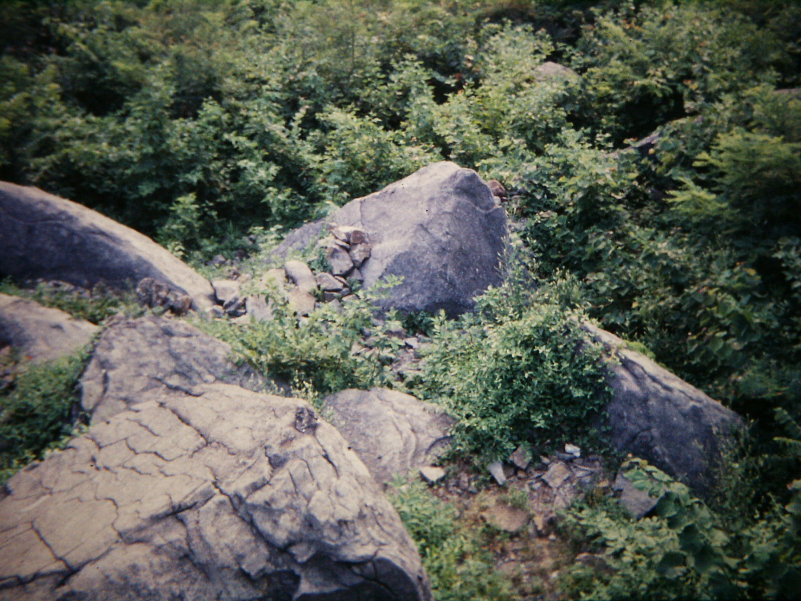
Gettysburg from the West, 1863
A wartime photograph looking east toward the town of Gettysburg from the west, taken in 1863 and formerly attributed to Mathew Brady. The image captures the open terrain and farmland that characterized the approaches to the town during the battle.
Source: Wikimedia Commons
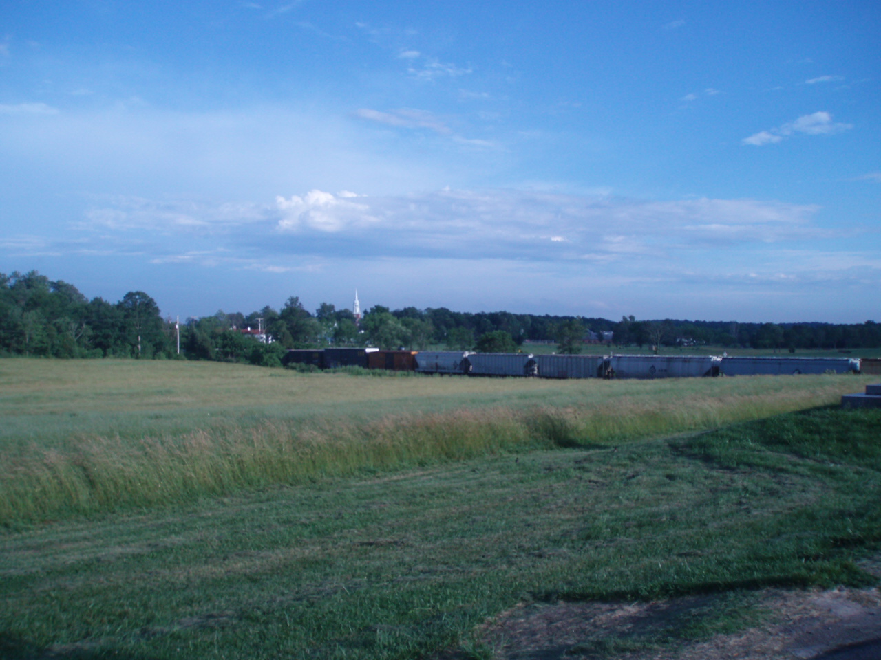
Little Round Top, Gettysburg Battlefield
Little Round Top, the rocky hillside at the southern end of the Union line that was the site of fierce fighting on July 2, 1863. Union forces defended this critical high ground against Confederate assault, preventing a flanking attack that could have decided the battle.
Source: Wikimedia Commons
McPherson’s Ridge, Gettysburg
McPherson’s Ridge, the open farmland west of Gettysburg where the first day’s battle opened on July 1, 1863. Union cavalry under General Buford initially contested this ground before the Iron Brigade and other infantry units continued the fight.

Source: Wikimedia Commons
Devil’s Den, Gettysburg Battlefield
Devil’s Den, a jumble of large boulders at the base of Little Round Top that served as a natural fortification for Confederate sharpshooters during the fighting on July 2, 1863. The rocky outcrop is one of the most visited and photographed landmarks on the battlefield.
Monuments and Memorials

Source: Wikimedia Commons
General Warren Statue, Little Round Top
The bronze statue of Major General Gouverneur K. Warren atop Little Round Top at Gettysburg National Military Park. Warren recognized the tactical importance of the undefended hill on July 2, 1863, and rushed Union troops to hold it, an act credited with saving the Union left flank.
Source: Wikimedia Commons
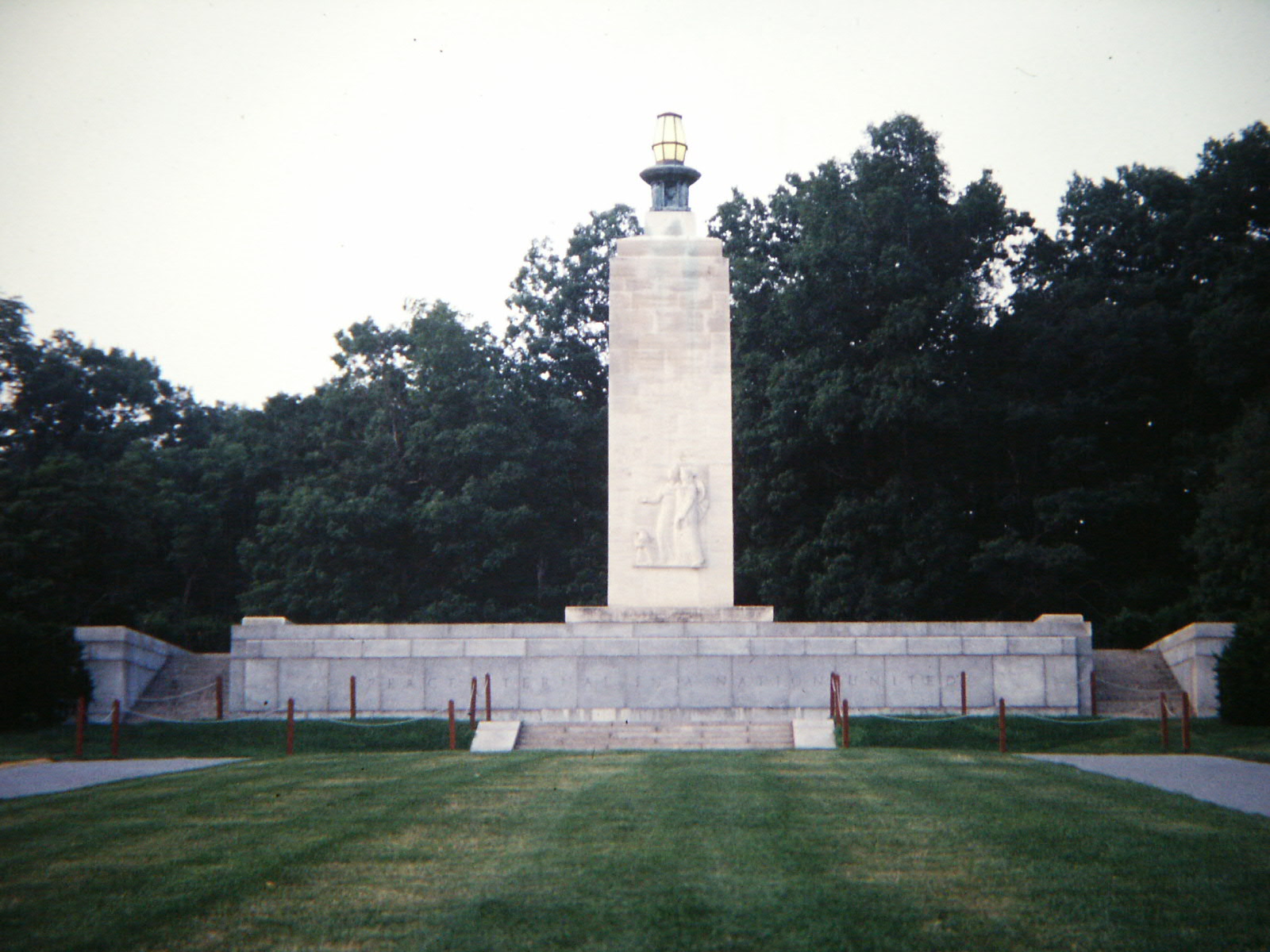
Eternal Light Peace Memorial, Gettysburg
The Eternal Light Peace Memorial on Oak Hill at Gettysburg National Military Park, dedicated in 1938 by President Franklin D. Roosevelt on the 75th anniversary of the battle. The flame atop the memorial burns continuously as a symbol of reconciliation between North and South.

Source: Wikimedia Commons
Virginia Memorial, Gettysburg Battlefield
The Virginia Memorial on Seminary Ridge at Gettysburg, dedicated in 1917. Topped by a bronze equestrian statue of General Robert E. Lee, it marks the position from which Lee watched Pickett’s Charge on July 3, 1863. It was the first Confederate state monument erected at Gettysburg.

Source: Wikimedia Commons
Gettysburg National Cemetery
Gettysburg National Cemetery, established in 1863 to inter the Union soldiers who fell during the three-day battle. President Abraham Lincoln delivered the Gettysburg Address here at the cemetery’s dedication on November 19, 1863. The cemetery is now part of Gettysburg National Military Park.
Historic Images
Source: Library of Congress
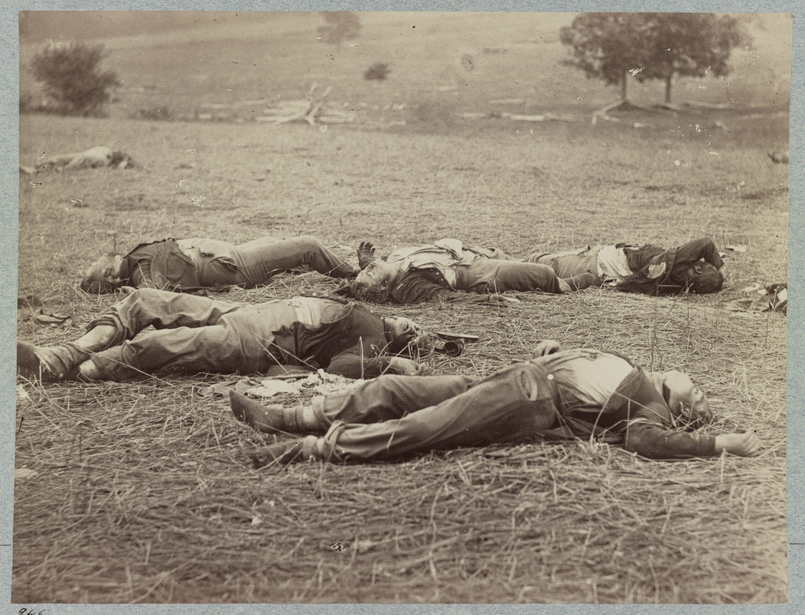
Federal Dead on the Gettysburg Battlefield, July 1863
Photograph of Union soldiers killed on the first day of the Battle of Gettysburg, July 1, 1863. From Alexander Gardner’s Photographic Sketch Book of the War (1866), this image is one of the earliest documentary war photographs and a powerful record of the human cost of the battle.

Source: Library of Congress
A Sharpshooter’s Last Sleep, Gettysburg, 1863
“A Sharpshooter’s Last Sleep,” photographed by Alexander Gardner at Devil’s Den, Gettysburg, July 1863. One of the most iconic images of the Civil War, it appeared in Gardner’s Photographic Sketch Book of the War. Historians have established that this image was staged by Gardner after the battle.
Source: Library of Congress
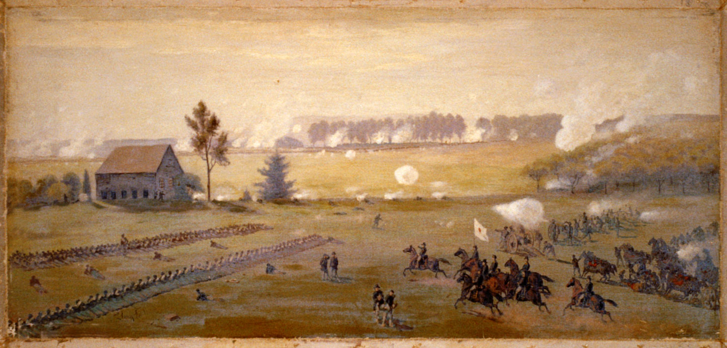
The Peach Orchard at Gettysburg — Edwin Forbes
A painting by Civil War artist Edwin Forbes depicting General Daniel Sickles at the Peach Orchard salient on the afternoon of July 2, 1863, as Confederate forces massed for assault. Forbes was an eyewitness artist who sketched battle scenes for Frank Leslie’s Illustrated Newspaper.
Source: Mathew Brady / Library of Congress Flickr Commons
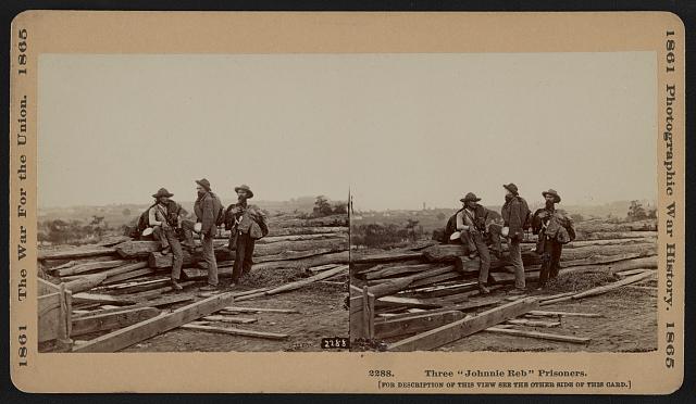
Three Confederate Prisoners on Seminary Ridge, Gettysburg, July 1863 (LOC)
Three Confederate prisoners photographed by Mathew Brady’s team on Seminary Ridge, Gettysburg, Pennsylvania, in mid-July 1863, following the Battle of Gettysburg. Seminary Ridge was a key Confederate position during the battle, running parallel to and west of Cemetery Ridge. Source: Library of Congress, Flickr Commons, LOC 5598385750. No known restrictions on publication.
Maps and Diagrams

Source: Wikimedia Commons
Map of the Battle of Gettysburg, 1863 (WDL9566)
Color manuscript map of the Battle of Gettysburg attributed to Capt. William H. Willcox, aide-de-camp to Gen. John F. Reynolds, showing Union and Confederate troop positions, roads, and terrain. Source: World Digital Library / Library of Congress, hosted on Wikimedia Commons. Public domain — no known restrictions.
Source: Wikimedia Commons
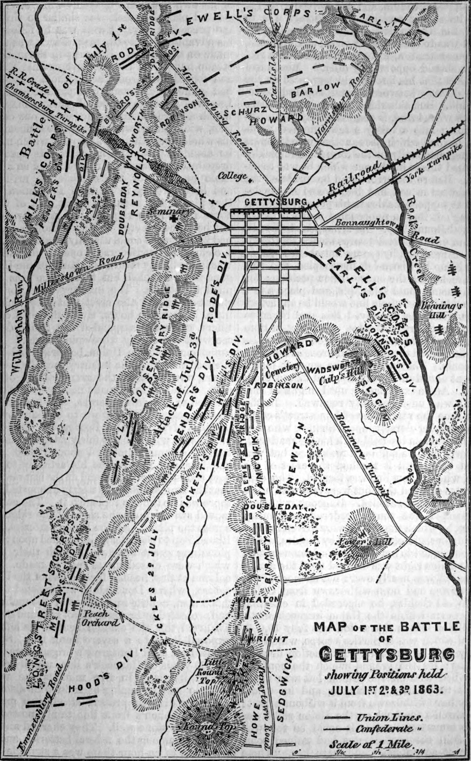
Map of the Battle of Gettysburg – Troop Positions, July 1st–3rd, 1863
Engraved diagram map of the Battle of Gettysburg showing troop positions for all three days of battle (July 1–3, 1863). Originally published in The American Cyclopædia, D. Appleton & Company, 1879. Source: Wikimedia Commons. Public domain.
Source: Library of Congress
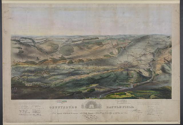
Gettysburg Battlefield Bird’s-Eye View Lithograph, c.1863
A color bird’s-eye view lithograph of the Gettysburg battlefield by John B. Bachelder and W. Endicott & Co., circa 1863. Shows the positions of Union and Confederate armies during the battle. Includes an inset map of Soldiers’ National Cemetery. No known copyright restrictions – Library of Congress Prints & Photographs Division.
Source: Library of Congress
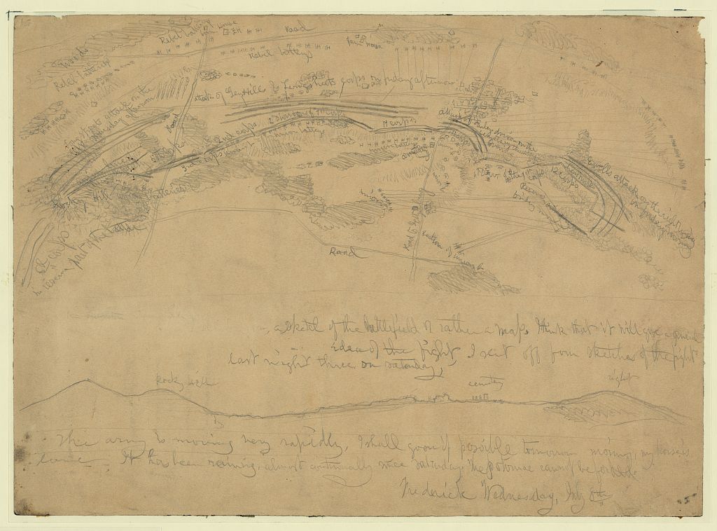
Sketch Map of the Battle of Gettysburg – Edwin Forbes, 1863 (High-Resolution)
A pencil sketch map of the Battle of Gettysburg drawn by Civil War artist Edwin Forbes on July 8, 1863, just days after the battle, titled “Sketch map of the battle of Gettysburg, made while on the march toward Frederick, Md.” A rare primary document showing troop positions and handwritten annotations. No known copyright restrictions – Library of Congress Prints & Photographs Division, Morgan Collection of Civil War Drawings.
Gettysburg National Cemetery

Source: Library of Congress
Soldiers’ National Monument at Gettysburg National Cemetery
The 1869 Soldiers’ National Monument at Gettysburg National Cemetery (originally Soldiers’ National Cemetery), a United States national cemetery just outside Gettysburg, Pennsylvania. The cemetery was created for Union casualties of the July 1–3, 1863 Battle of Gettysburg. President Abraham Lincoln delivered the Gettysburg Address here four months after the battle. Photo by Carol M. Highsmith, June 14, 2019. No known copyright restrictions – Library of Congress, Prints & Photographs Division, Carol M. Highsmith Archive.

Source: Library of Congress
A Portion of Gettysburg National Cemetery – Grave Rows
A portion of Gettysburg National Cemetery (originally Soldiers’ National Cemetery), a United States national cemetery just outside Gettysburg, Pennsylvania. Shows rows of white gravestones across the cemetery grounds. The cemetery contains 3,512 interments from the Civil War, including the graves of 979 unknowns. Photo by Carol M. Highsmith, June 14, 2019. No known copyright restrictions – Library of Congress, Prints & Photographs Division, Carol M. Highsmith Archive.
Source: Library of Congress
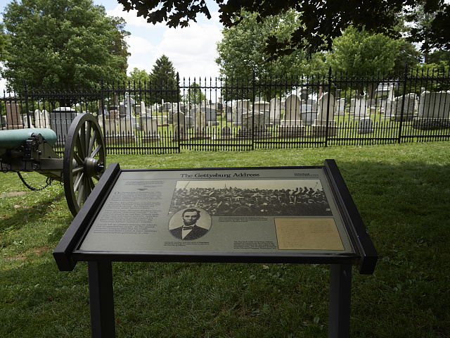
Marker at the Site of the Gettysburg Address, Gettysburg National Cemetery
The marker at the site of the Gettysburg Address at Gettysburg National Cemetery, Pennsylvania. Lincoln delivered the address here on November 19, 1863. No known copyright restrictions – Library of Congress, Carol M. Highsmith Archive.
Source: Library of Congress
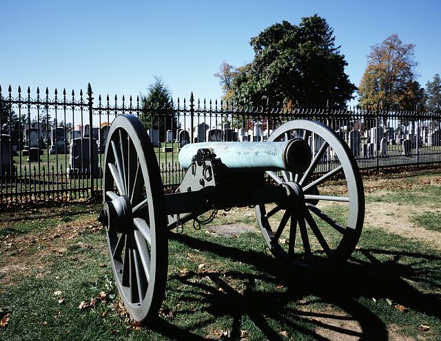
Gettysburg National Cemetery with Civil War Cannon
Gettysburg National Cemetery, Gettysburg, Pennsylvania. A Civil War cannon is silhouetted against the historic iron fence. The cemetery holds 3,512 interments from the Civil War. Photo by Carol M. Highsmith, 1980–2006. No known copyright restrictions – Library of Congress, Carol M. Highsmith Archive.